Geography
|
|
Area
Total Area: 231,800 square miles
Land Area: 226,000 square miles
Water Area: 5,980
size comparative to U.S. territory: slightly smaller than Texas (268,820 sq miles)
World ranking for size: 47th largest country by area.
Border
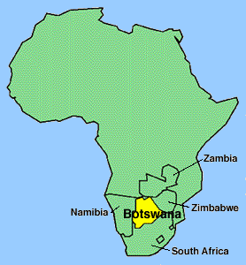
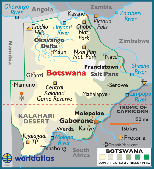
Total distance: Namibia to the west, Zimbabwe to the east, South Africa to the west and Zambia to the north east.
Total Distance of all land boundaries: 4,013 km
Total distance of coastlines: 0 (landlocked)
Climate
semiarid; warm winters and hot summers
Terrain
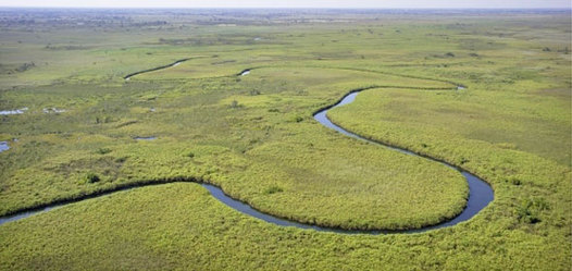
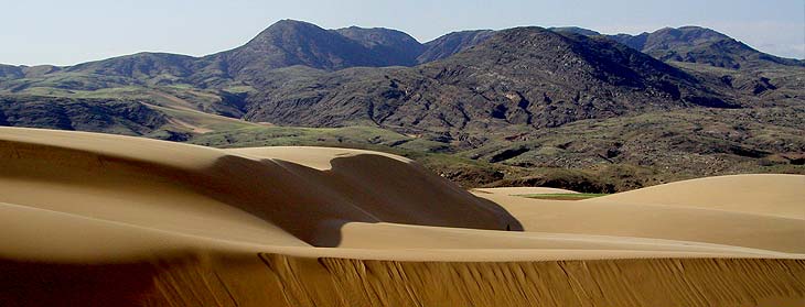
Predominantly flat to gently rolling tableland; Kalahari Desert in southwest
Elevation
Points of elevation: Lowest: junction of the Limpopo and Shashe Rivers (513 m), Highest: Tsodillo Hills (1,489 m)
Natural Disaster
They are most effected by floods, they receive a large amount of rain in a short period of time. There is not proper drainage in Botswana.
Environmental concerns:
Affected by periodic droughts, and seasonal August winds blow from the west, carrying sand and dust, which can obscure visibility.
Total Area: 231,800 square miles
Land Area: 226,000 square miles
Water Area: 5,980
size comparative to U.S. territory: slightly smaller than Texas (268,820 sq miles)
World ranking for size: 47th largest country by area.
Border
Total distance: Namibia to the west, Zimbabwe to the east, South Africa to the west and Zambia to the north east.
Total Distance of all land boundaries: 4,013 km
Total distance of coastlines: 0 (landlocked)
Climate
semiarid; warm winters and hot summers
Terrain
Predominantly flat to gently rolling tableland; Kalahari Desert in southwest
Elevation
Points of elevation: Lowest: junction of the Limpopo and Shashe Rivers (513 m), Highest: Tsodillo Hills (1,489 m)
Natural Disaster
They are most effected by floods, they receive a large amount of rain in a short period of time. There is not proper drainage in Botswana.
Environmental concerns:
Affected by periodic droughts, and seasonal August winds blow from the west, carrying sand and dust, which can obscure visibility.